Topography Terms
Along Trail- The check point should be visible as you move forward down the path.
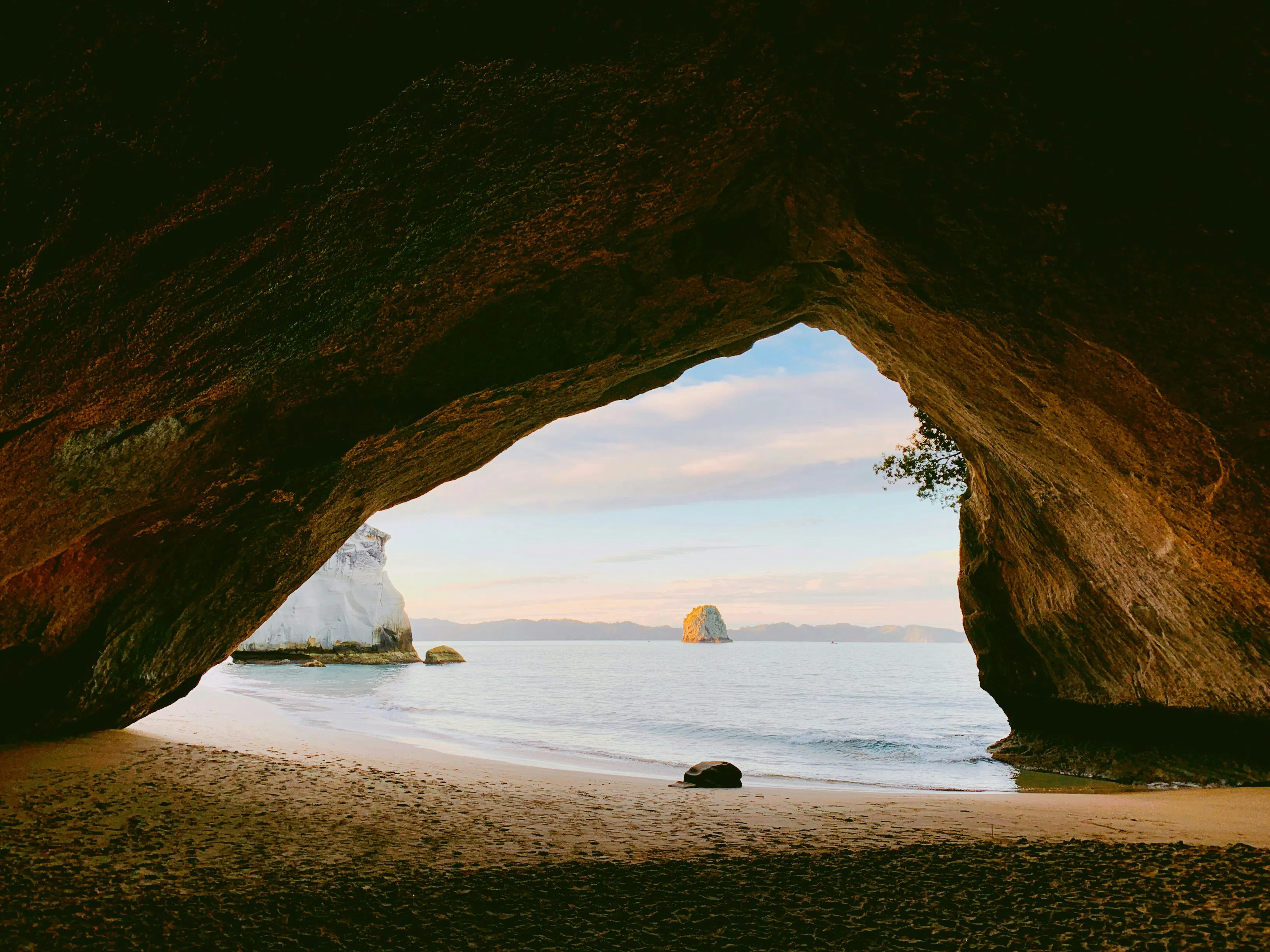
Beach- a strip of land at the edge of a body of water covered with sand, stones and/or pebbles

Bend- a curve or slight turn.
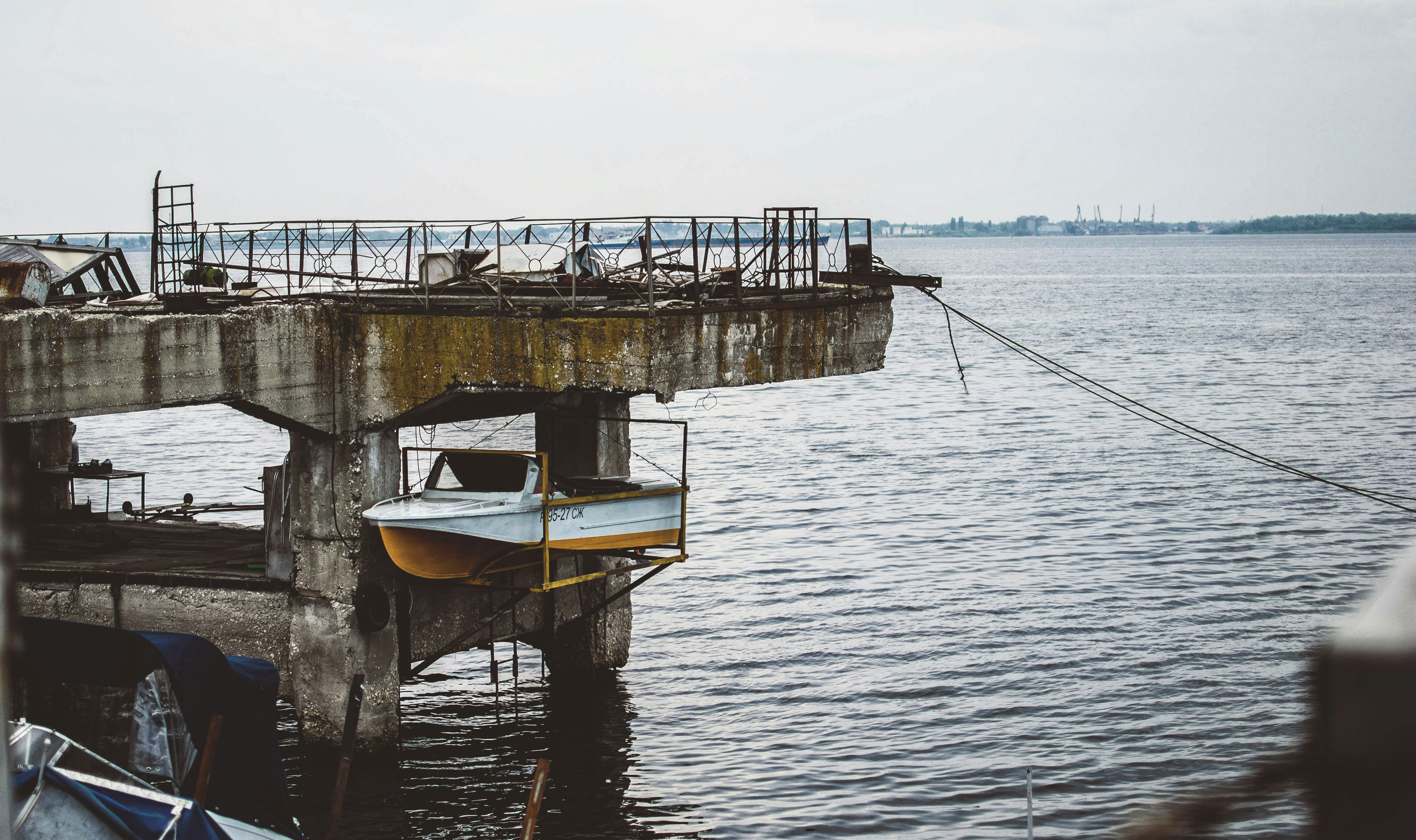
Boat Landing- a structure, usually concrete, at sea level used to launch or remove boats from the water. A ramp placed into the water. An incline that enters a body of water.
Brush Pile- a mound or pile of appropriate woody material fashioned by piling brush and loose branches on top of a base comprised of larger logs or other natural materials

Clearing- an open space in a forest or wooded area. A small area in a forest where there are no trees or bushes.

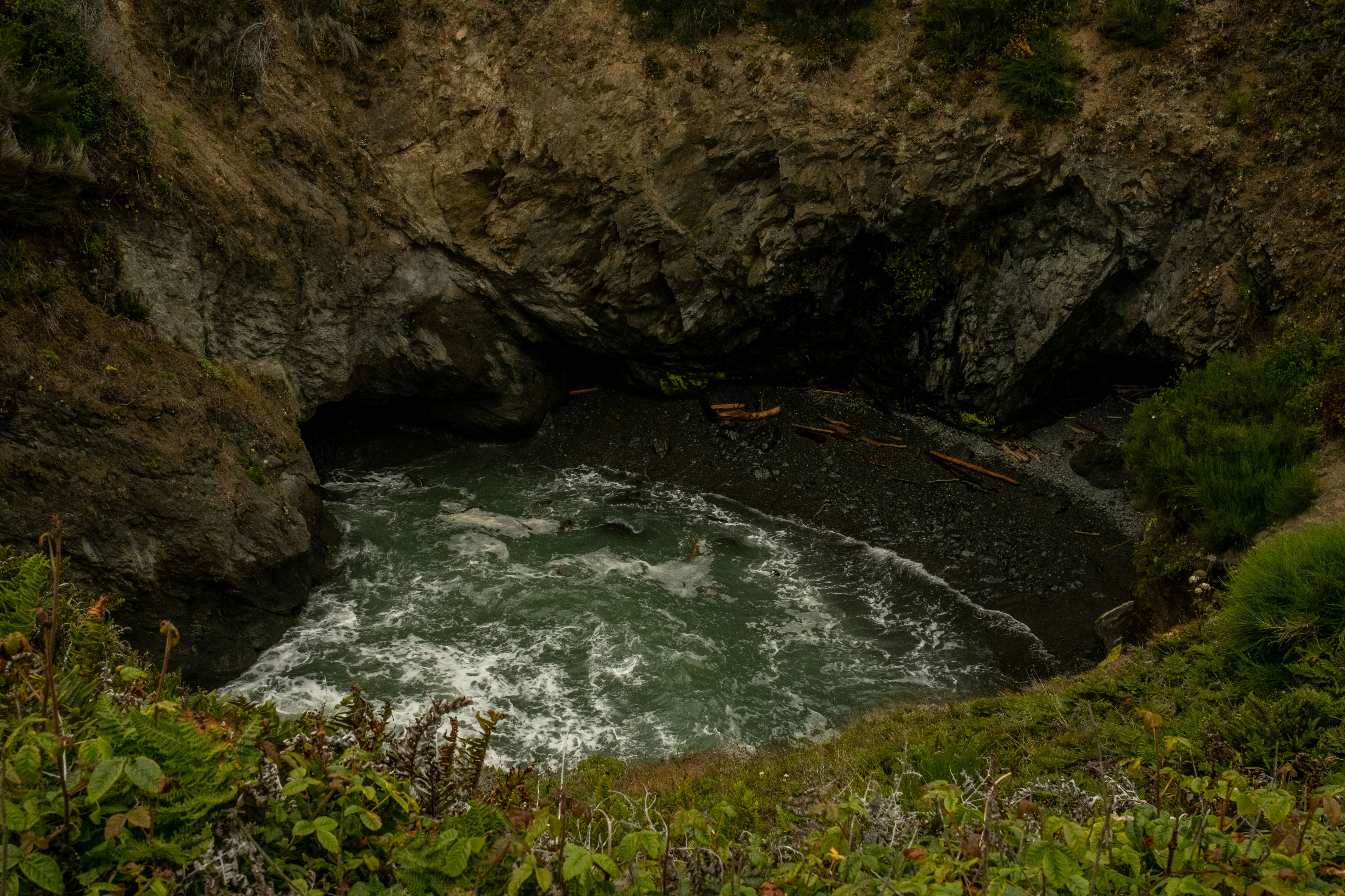
Cove- a small bay or coastal inlet. Coves usually have narrow, restricted entrances, are often circular or oval, and are often situated within a larger bay. Small, narrow, sheltered bays, inlets, creeks, or recesses in a coast are often considered coves.
Creek- an inlet in a shoreline, a channel in a marsh, or another narrow, sheltered waterway. A stream, brook, or minor tributary of a river. a natural stream of water normally smaller than and often tributary to a river.

Creek Junction- a point where two or more small flowing bodies of water meet.
Depression- a landform sunken or depressed below the surrounding area. A hole. An upside-down hill. A low point or sinkhole in the terrain.
Fence- a barrier, railing, or other upright structure, typically of wood or wire, enclosing an area of ground to mark a boundary, control access, or prevent escape.

Fenced corner- the point where two perpendicular fence walls meet, usually to create a 90-degree angle

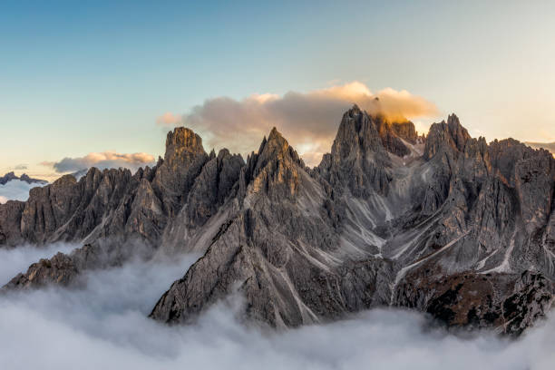
Hill- a naturally raised area of land. A landform that extends above the surrounding terrain. It often has a distinct summit, and is usually applied to peaks which are above elevation compared to the relative landmass, though not as prominent as mountains.

Hilltop- the summit of a hill. The highest part of a hill. The part of a hill rather than its sloping sides.

HQ- Headquarters. Home base. Main meeting or gathering area.
Junction- a point where two or more things are joined. a place where several routes, lines, or roads meet, link, or cross each other

Knoll- a small hill or mound. A little round hill.

Lake- a body of water surrounded by land. A large inland body of standing water. A body of water deep enough at points where plants potentially could not cover the surface.

Launch- the slip or descent whereas a ship is put or launched into the water. A boat landing.
Marsh- a wetland, an area of land where water covers ground for long periods of time. Marshes are usually treeless and dominated by grasses and other herbaceous plants
Herbaceous Plants- (of, relating to, or having the characteristics of an herb. b. of a stem: having little or no woody tissue and persisting usually for a single growing season. 2.: having the texture, color, or appearance of a leaf.)
Mountain- a large natural elevation of the earth's surface rising abruptly from the surrounding level; a large steep hill.
Overlook- a commanding position or view.
Pier- a platform supported on pillars or girders leading out from the shore into a body of water, used as a landing stage for boats
Pond- a pond is a small, still, land-based body of water formed by pooling inside a depression, either naturally or artificially. A body of water with a shallow depth where plants could potentially cover the entirely surface.
Re-entrant- a terrain feature formed by two parallel ridges or spurs with low ground in between them. Basically, a small, usually steep valley or a ravine, cut into a hillside, mostly.
Ridge- a long narrow hilltop, mountain range, or watershed. A ridge is a long, narrow, elevated strip of land or any raised strip or band. A ridge is a line that rises above what it is attached to.
River- a river is a natural flowing watercourse, usually a freshwater stream, flowing on the Earth's land surface or inside caves towards another waterbody at a lower elevation, such as an ocean, sea, bay, lake, wetland, or another river.

Saddle- the bottom of the slope between two hills
Shoreline- the region where the water bodies such as lakes, seas, and oceans meet the land. It can also be considered the boundary between the land surface and water bodies.

Signpost- a raised marker, usually on the side of a road or trail, that provides some type of information. (Be sure to check at the base, at and around the post. Sometimes the electronic device will be there, but there will be no flag present.)

Spur- a lateral ridge or tongue of land descending from a hill, mountain, or main crest of a ridge. It can also be defined as another hill or mountain range which projects in a lateral direction from a main hill or mountain range.
Swamp- an area of land permanently saturated, or filled, with water. Many swamps are even covered by water. Swamps are filled with trees.

Teepee- a portable, conical (cone shaped) tent made of skins, cloth, or canvas on a frame of poles, used by North American Indians of the Plains and Great Lakes regions.

Tower- a tall, narrow building, either freestanding or forming part of a building. A tall, usually slender, structure.

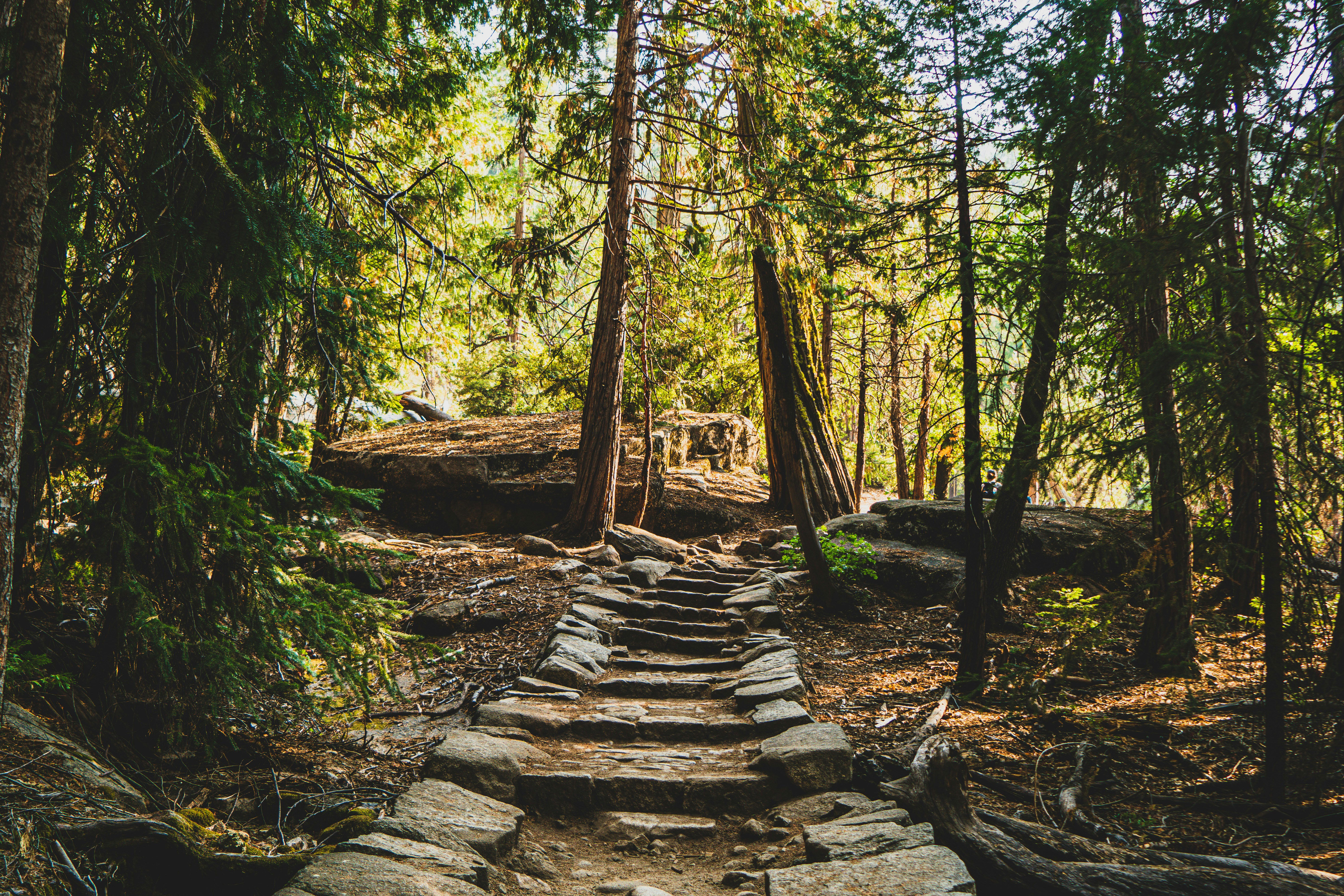
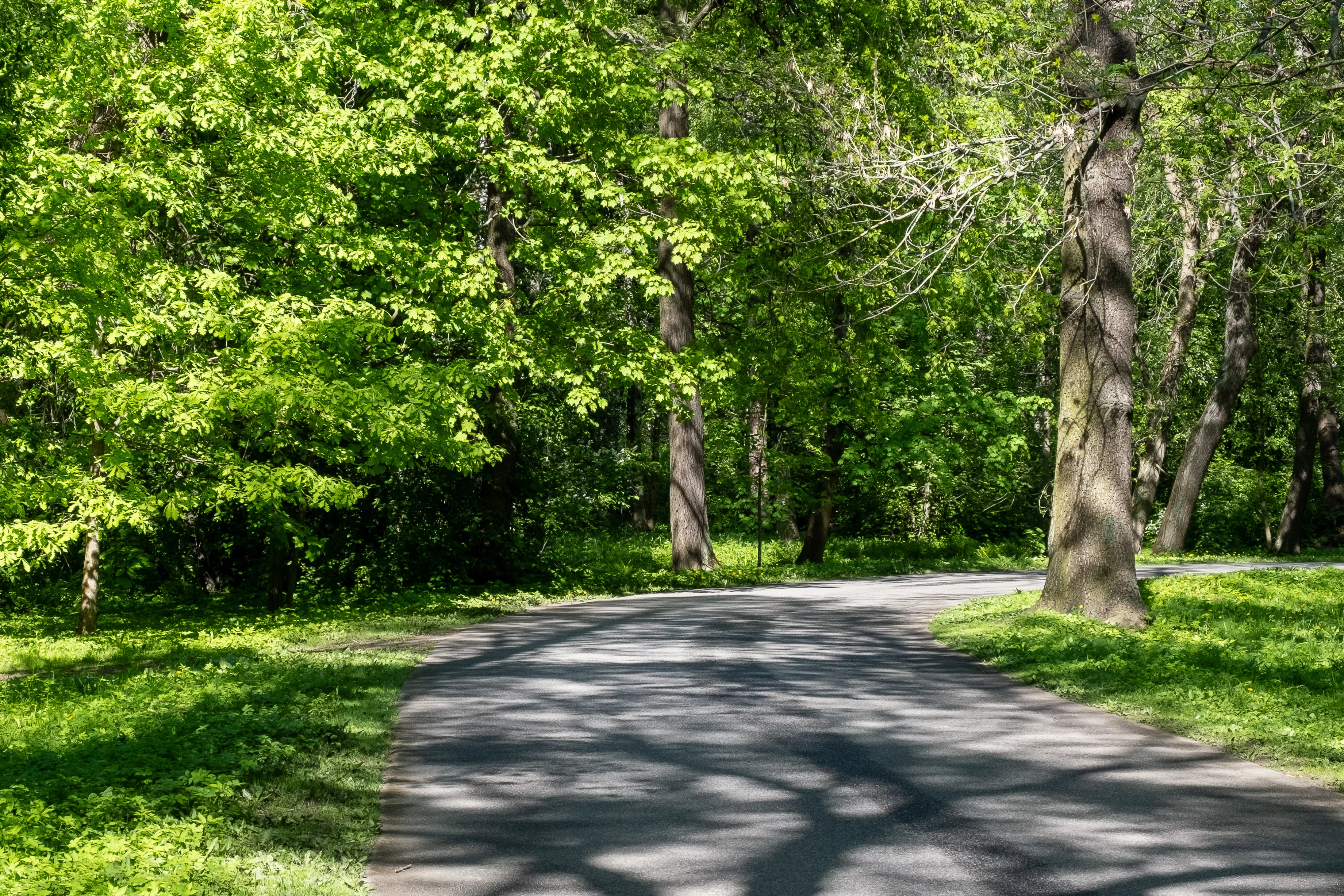
Trail- a trail, also known as a path or track, is an unpaved lane or a small paved road, usually passing through a natural area.

Trailhead- the place where a trail begins.
Waterfall- a cascade of water falling from a height, formed when a river or stream flows over a precipice or steep incline. Is any point in a river or stream where water flows over a vertical drop or a series of steep drops.
